May 29 (Punjab Khabarnama) : Monsoon is expected to make onset over Kerala and some parts of northeast India during the next 24 hours, the India Meteorological Department (IMD) said in its Wednesday bulletin. The development is also expected to bring relief to the prevailing heat wave conditions over northwest and central India from Wednesday.
“Gradualfall in maximum temperatures by 3-4°C very likely over Northwest & Central India during next 3-4 days,” the IMD said.
The IMD said that the conditions are expected to become favourable for further advancement of the southwest monsoon into some parts of the South Arabian Sea and the remaining parts of Maldives and the Comorin area, some parts of Lakshadweep area, some more parts of the Southwest & Central Bay of Bengal, and Northeast Bay of Bengal during the same period.
Last year monsoon onset was delayed by a week on June 8.
According to the IMD, the normal monsoon onset over Kerala is June 1 and thereafter it advances northwards and then to the rest of the country around July 15. Monsoon normally advances over northeast India around June 5. But, during some years when the Bay of Bengal arm of the monsoon is active, the monsoon advances over northeast India at the same time
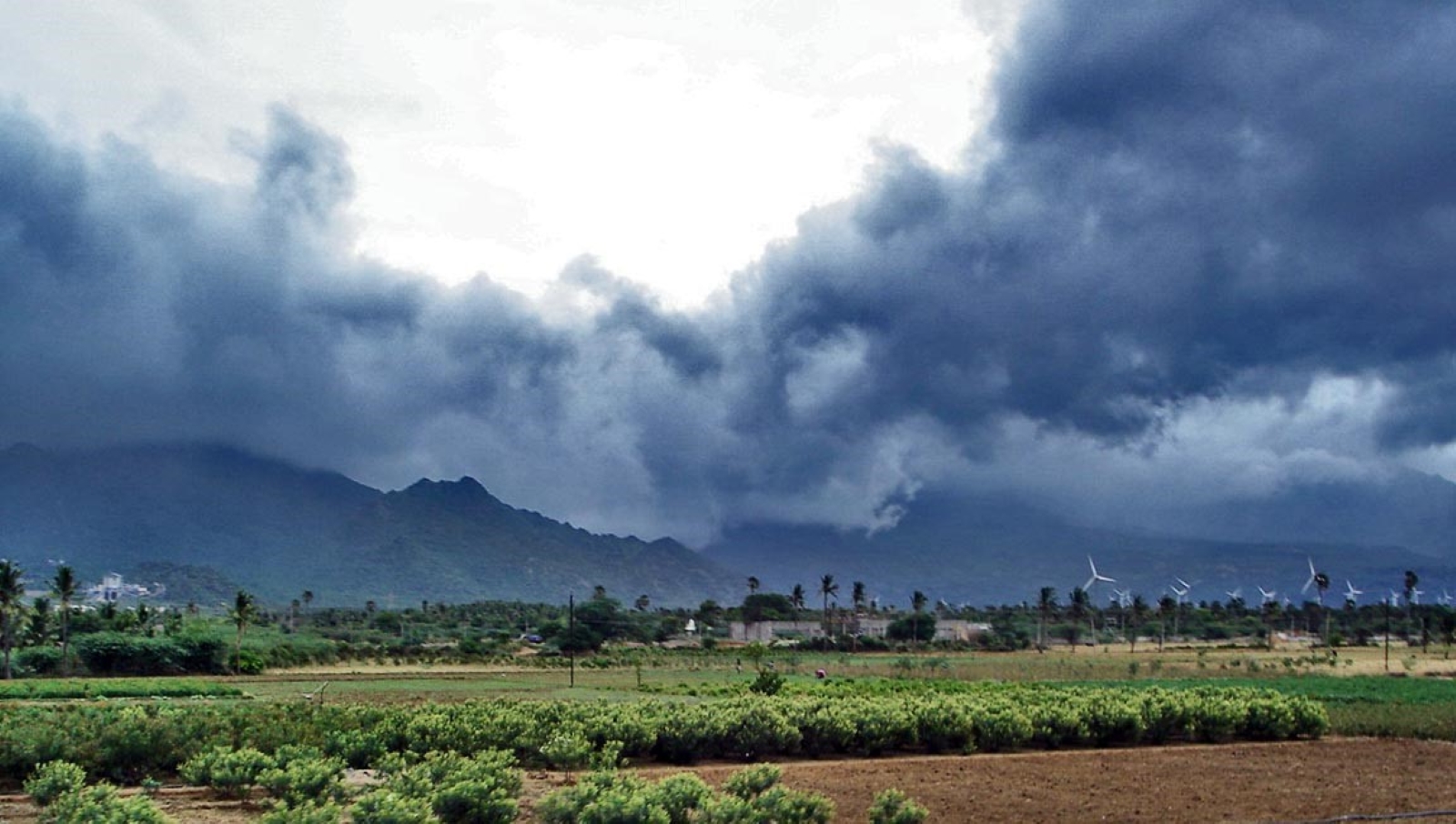
“The Bay of Bengal arm of the monsoon is very active due to severe cyclone ‘Remal’ which has pulled the monsoon flow over the region. There has been extremely heavy rainfall over northeastern states during the past two days. Moreover, all monsoon onset criteria are being met over Kerala also during the past two days,” said M Mohapatra, director general, IMD.
The onset of the monsoon over Kerala is declared on the second day if after May 10, at least 60% of 14 stations — Minicoy, Amini, Thiruvananthapuram, Punalur, Kollam, Allapuzha, Kottayam, Kochi, Thrissur, Kozhikode, Thalassery, Kannur, Kudulu and Mangalore — report rainfall of 2.5mm or more for two consecutive days , provided the wind pattern is south-westerly and Outgoing Longwave Radiation (OLR) is low. OLR represents the total radiation going to space emitted by the atmosphere or the extent of cloudiness.
Monsoon is likely to make onset over Kerala on May 31, with a model error of +/-4 days, IMD had forecast on May 15. IMD’s operational forecasts of the date of monsoon onset over Kerala during the past 19 years (2005-2023) were proved to be correct except in 2015, IMD said in a statement.
Kerala has been hit by heavy rains this week, with scores of houses suffering damage, roads submerged, trees uprooted, flood water entering houses and trains running late as steady downpours continued to lash the state.
Earlier this week, the IMD sounded a yellow alert in seven districts, including Thiruvananthapuram, Kollam, Pathanamthitta, Alappuzha, Idukki, Kottayam and Ernakulam. A yellow alert indicates heavy rainfall between 6 cm and 11 cm. The weather department predicted isolated heavy rain in these districts in the coming hours.
The advance of the southwest monsoon over the Indian mainland is marked by monsoon onset over Kerala and is an important indicator characterising the transition from a hot and dry season to a rainy season.
According to India’s agriculture ministry, 51% of farmed areas, accounting for 40% of production, are rain-fed, making the monsoon critical. With 47% of the country’s population dependent on agriculture for their livelihood (according to this year’s Economic Survey), a bountiful monsoon has a direct correlation with a healthy rural economy.
A cyclonic circulation is lying over northeast Assam and the neighbourhood in lower and middle tropospheric levels. Under its influence, widespread light to moderate rainfall accompanied by thunderstorms, lightning and gusty winds (30-40 kmph) is likely over Arunachal Pradesh, Assam, Meghalaya, Nagaland, Manipur, Mizoram & Tripura and Sub-Himalayan West Bengal and Sikkim during next seven days, said IMD.
Isolated heavy rainfall is very likely over Arunachal Pradesh, Assam, Meghalaya, Sub Himalayan West Bengal and Sikkim during the next five days and isolated heavy rainfall over Nagaland, Manipur, Mizoram and Tripura on May 30, it further said. Moreover, isolated to scattered light/moderate rainfall over Bihar, Jharkhand, Gangetic West Bengal, and Odisha during the next five days and accompanied by thunderstorms, lightning and gusty winds (30-40 kmph) likely over the region from May 31 to June 2.
“A shear zone hear zone is running over south peninsular India in middle tropospheric levels. Strong westerly winds are prevailing along the Kerala coast. Under its influence, widespread light to moderate rainfall accompanied by thunderstorms, lightning and gusty winds (30-40 kmph) likely over Kerala & Mahe, Lakshadweep, Andaman & Nicobar Islands; isolated to scattered light to moderate rainfall over Tamil Nadu, Puducherry, Karaikal, Karnataka during next seven days and Coastal Andhra Pradesh, Telangana, Rayalaseema during June 1 to 4,” read the IMD’s bulletin.
“Isolated heavy rainfall is very likely over Kerala & Mahe during the next five days, over Andaman & Nicobar Islands from May 31 to June 2, Tamil Nadu and South Interior Karnataka on June 1 and 2,” it said.
Meanwhile, a fresh western disturbance is expected to impact the Western Himalayan region on May 30.
Under its influence, isolated to scattered light rainfall accompanied by thunderstorms, lightning is very likely over Uttarakhand, Himachal Pradesh from May 30 to June 2 and Jammu-Kashmir-Ladakh-GilgitBaltistan-Muzaffarabad from May 30 and 31, the IMD said.
“This is expected to reduce the intensity of heat over the Western Himalayan region during the next two days,” Mohapatra said.